
Warfield, Kentucky - 1:1 Scale Realistic American Appalachian Town
by artemin01 · 2026-09-18 · Maps
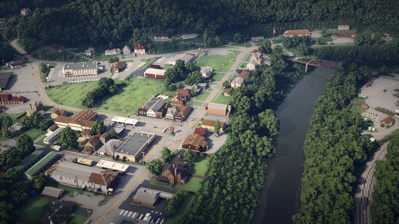
Project #02: Warfield, Kentucky is officially complete. Following my 1:1 recreation of Marietta, Indiana , I wanted to tackle a completely different geographic challenge: The Appalachian Mountains. Unlike the flat, predictable grids of the Midwest, Appalachian urban planning is defined by extreme topography. Towns are squeezed into river valleys, forcing highways and railroads to wrap around mountains at sharp diagonals. The Topography & Grid Covering an 853x985 block area, the landscape was generated using real-world GIS elevation data to perfectly capture the Appalachian mountains and the Tug Fork River. Because of this, almost the entire map is built "off-grid." Buildings, parking lots, and major roads (like US Hwy 52, Groundhog Hollow, and Riverfront Road) were built at their exact real-world diagonal angles. Map Features: 1:1 Commercial Accuracy: Custom vanilla display entities were used to create hyper-realistic logos and signs for the Warfield IGA, Dollar General, Marathon Gas, Adkins Fastop, and Walgreens. Custom Architecture: The Warfield Baptist Church and Church of God feature custom entity roof angles and crosses. (Note: Private residential homes use custom assets of si